

Update regarding next week’s severe threat
Due to varying levels of spread and uncertainty in the guidance, our team has decided not to pursue the incoming storm setup next week. There were a few factors behind our decision:
For one, a ridge is developing over the Rockies, which suppresses the setup of the trough ejection. The trough itself is not very amplified, which historically is not a positive sign for large-scale tornadic activity. Models, crucially the ECMWF and GFS, have struggled to nail down the dates of the greatest severe threat.
Additionally, this coincided with time-sensitive logistical and resource challenges that would have complicated a deployment on this event. We are, however, closely monitoring for the potential of other setups following this system.
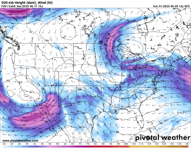
The 12z GFS model run for the relevant period, showing a loop of the 500 millibar heights (dam) and wind (kts).